8 Unforgettable Hikes Near Telluride, Colorado (Map + Photos)
Table of Contents
ToggleBest Hikes Near Telluride CO
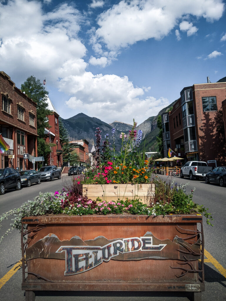
Telluride, tucked away in the San Juan Mountains is one of Colorado’s most gorgeous mountain towns.
The town of Telluride offers outdoor enthusiasts an array of unforgettable summer hikes with incredible scenery every step of the way.
Discover easy trails near town, gorgeous waterfall hikes, or try some more challenging hikes that take you high into the mountains. Telluride offers hikes for families at every skill level.
Our hiking guide will give you all the details about the best hikes in Telluride.
We’ve included important information about trail distance, elevation gain, how to get to the trailhead, plus a detailed description of each hike with pictures!
Here are 8 of the best hikes in Telluride Colorado.
Let’s go!
Don’t forget to check out the most incredible Things to do In Telluride when you visit this summer!
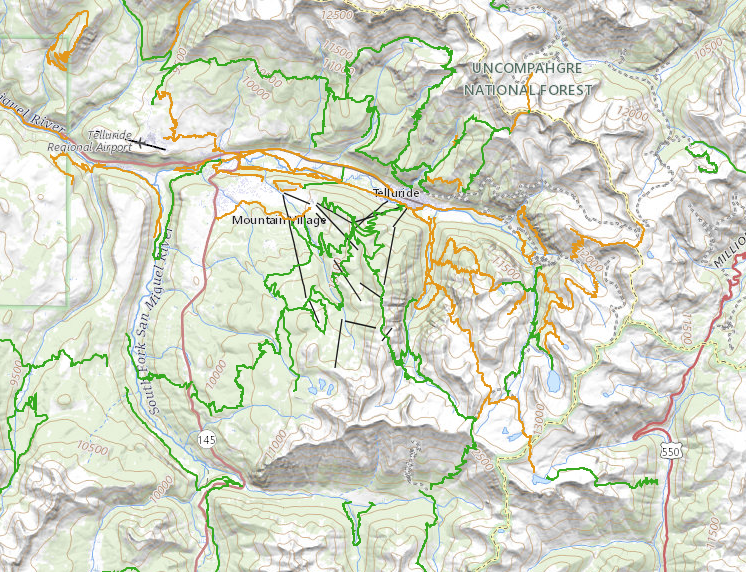
Telluride Hiking Trail Map
When you get to Telluride, you might find it helpful to head downtown and check out the visitors center to grab a free map of Telluride you can easily reference while visiting this charming town.
Telluride also offers an online Telluride Hiking Trails Map that Shows you the location of every hiking trail in the area.
Hikes in Telluride you Don’t Want to Miss this Summer
There are over 90 total hiking trails near Telluride, making it hard to choose just a handful of hikes to check off the list. So here is a list of the best hikes in Telluride based on location, scenery, and ease of access.
Bridal Veil Falls
Bear Creek Trail Falls
Cornet Falls
Jud Weibe Trail
Hope Lake Hike
Mount Sneffels
Blue Lake Trail
Best Time of Year to Hike In Telluride
The hiking season in Telluride starts in May and ends in early October. But, If we were to pick the best time of year to explore Telluride hiking trails, we would have to say late June through August. You’ll be able to enjoy alpine lakes, waterfalls, and high country meadows filled with beautiful wildflowers.
Telluride Hikes Near Town
There are 4 hikes that start right from downtown. Try one of these popular Telluride hiking trails when you visit in the summer season.
1. Bridal Veil Falls
Trail Length: 2-miles out-and-back
Elevation Gain: 826 feet
Difficulty: Moderate
Trail Traffic: Heavy Use
Trailhead Directions: All Trails Map
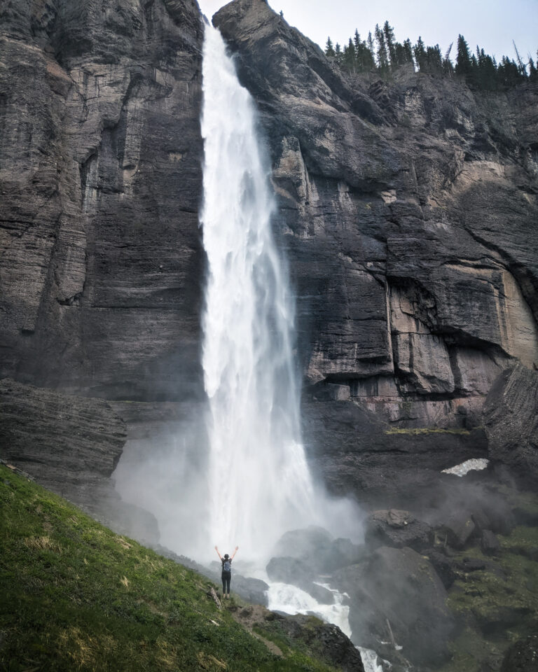
Bridal Veil Falls in Telluride is Colorado’s tallest waterfall, at 365 ft, visitors come from all over for the chance to see it. It’s one of the best trails in Telluride, sitting at the end of the box canyon.
Also being one of the most popular trails in Telluride, the 1.2-mile hike can also be accessed by 4 wheel drive high clearance vehicles on a jeep road and offers stunning views of the Valley.
When we did this hike, we went up the trail and took the jeep road down. We didn’t like that the trail had so many tree roots, boulders, and river crossings (plus it was super busy) and we got a scenic view of Telluride valley on the way down by taking the road down. You just have to be mindful of all the vehicles.
To get to bridal veil falls from downtown telluride, head east on main street. This road turns into east hwy 145. The trailhead starts just past the Pandora Mill in a large parking area. If you have a 4×4 high clearance vehicle and don’t want to hike this trail, the road continues up to the base of the falls.
2. Bear Creek Trail
- Trail Length: 5-miles out-and-back
- Elevation Gain: 1,092 feet
- Difficulty: Moderate
Trail Traffic: Heavy Use
Trailhead Directions: All Trails Map
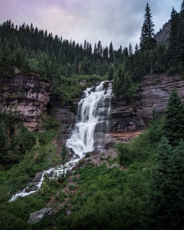
Hiking up to Bear Creek Falls in Telluride in Telluride, Colorado is an incredible experience that offers scenic views and rewards you with a cascading 80-foot waterfall on a moderately difficult trail.
Bear Creek is one of the most popular trails in the area and is a great family-friendly hike.
The trail starts downtown telluride at the end of south pine street where you will go on a 2.5-mile journey through bear creek preserve, making your way to stunning views of waterfalls.
On this hike, you will gradually gain 1000 ft in elevation on this colorado trail. This wide mountain trail traverses through Bear Creek Canyon with spectacular views.
3. Cornet Creek Falls Trail
Trail Length: 1.2-miles out-and-back
Elevation Gain: 725 feet
Difficulty: Moderate
Trail Traffic: Heavy Use
Trailhead Directions: All Trails Map
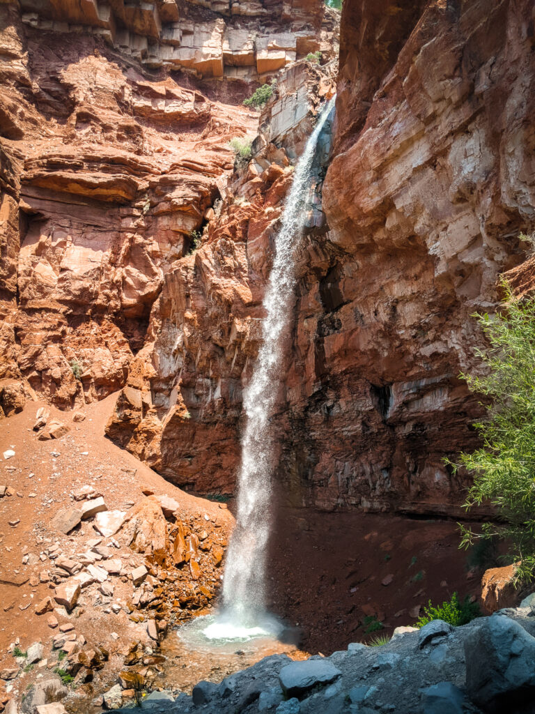
Cornet Creek Falls located just walking distance from historic downtown Telluride, is a must-see for any traveler who loves a rewarding mist on a hot summer day. This 80 ft waterfall is only .6 of a mile with only 301 gain in elevation.
The trail leading up to the falls is a bit of a scramble with loose gravel so make sure you wear shoes with good traction on this short but steep hike.
4. Jud Weibe Memorial Trail
Trail Length: 3 mile loop
Elevation Gain: 725 feet
Difficulty: Moderate
Trail Traffic: Heavy Use
Trailhead Directions: All Trails Map
The Jud Wiebe Memorial Trail in Telluride, Colorado is a hike the whole family will enjoy. This dog-friendly trail is a 3-mile loop. We recommend starting the trail at Aspen Street so you can Include the hike to the 80 ft Cornet Creek falls.
If you decide not to include Cornet Creek falls, you will start the hike by crossing the cornet creek bridge and then begin your ascent up the hillside to stunning panoramic views of downtown telluride, with wildflowers, and aspen groves along the way. The beginning of the trail is steep, gaining 1,200 feet in about a mile.
Directions to Jud Wiebe Trail
There is no parking lot for this hike so plan to park on the streets of town instead. Most of downtown telluride is limited to two-hour parking unless you head to the free parking lot at the Carhenge Lot on West Pacific Ave.
Hikes Near Telluride Colorado
If you’re looking for some high-altitude hikes near Telluride that will take you high into the mountains on some rocky switchbacks and into the beautiful backcountry, here are the best hikes near Telluride you should definitely put on your bucket list.
5. Hope Lake Hike Telluride
Trail Length: 6 miles out-and-back
Elevation Gain: 1,515 feet
Difficulty: Moderate
Trail Traffic: Heavy Use
Trailhead Directions: All Trails Map
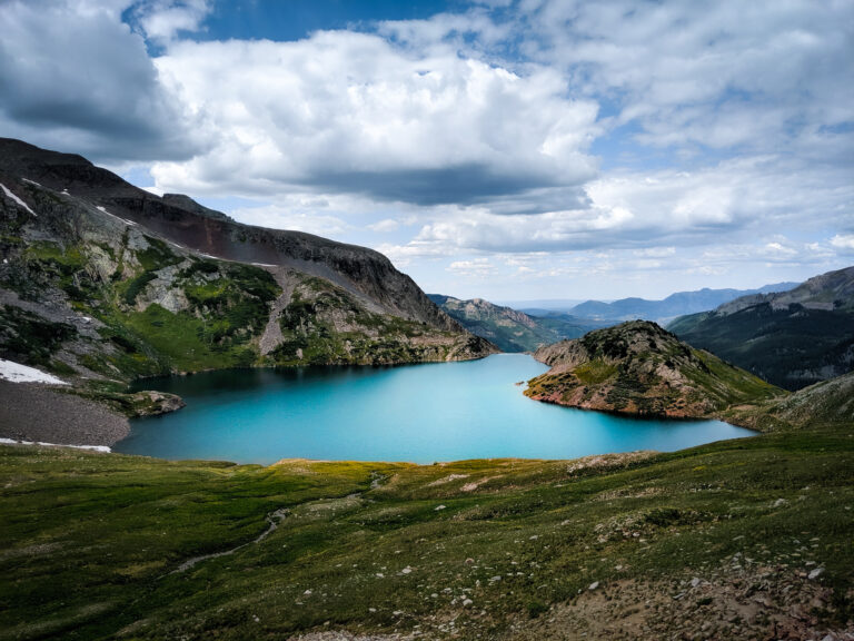
Looking for a beautiful alpine lake hike deep in the backcountry of the Uncompadre National Forest? Hope Lake Hike offers panoramic views of the San Juan Mountains, with meadows filled with colorful fields of wildflowers, ending at a glacier blue alpine lake. Hope lake is the best hikes around Telluride.
Starting at 10,750 ft in elevation, this 6 mile out and back trail takes you 1,515 ft into the mountains on a high trafficked trail.
My husband and I loved our hike to Hope Lake. Seeing the alpine lake was absolutely stunning with the mountains surrounding the lake.
Most hikers can complete the hike in 3-5 hours. But this all depends on your skill level, and how much time you spend hanging out at the lake and enjoying the scenery.
How to get to Hope Lake Trailhead:
In order to reach hope lake trailhead from Telluride, head west on hwy 124 towards tout lake, turn left on county rd 63A (follow the sign for trout lake). After driving past trout lake for about a mile, take a left onto Hope Lake Rd (FS RD #627) for 2.5 miles. This road gets pretty rough and a high clearance vehicle is recommended.
For more detailed information about this scenic hike, check out our Hope Lake Hiking Guide and find out why it’s the best day hike in Telluride.
6. Blue Lake via Bridal Veil Falls
Trail Length: 5.7-miles out-and-back
Elevation Gain: 1,843 feet
Difficulty: Moderate
Trail Traffic: Moderate Use
Trailhead Directions: All Trails Map
Starting from Pandora Mill either hike the trail or the road to the top of Bridal Veil Falls. You can drive to Bridal Veil falls if you have a high clearance 4×4 vehicle, but parking is limited. To get on to Blue Lakes Trail, you will follow the trail toward Bridal Veil Basin and hike the road next to the creek. After 2,000 feet of elevation gain and 3 miles, you will be at 12,400 feet with stunning views of Blue Lake.
7. Mount Sneffels
Trail Length: 7.1-miles out-and-back
Elevation Gain: 3,320 feet
Difficulty: Hard
Trail Traffic: Moderate Use
Trailhead Directions: All Trails Map
If you’re looking for an adventure, and you’re willing to put in the work, hiking to Mt. Sneffels is a great option for ambitious hikers. This 14er is located near Telluride, Colorado, and it’s not for the faint of heart, being a challenging trail with over 3,000 feet of elevation gain.
But with a little preparation and some basic knowledge, you can make the trek and enjoy the incredible views from the summit.
The Summit of Mount Sneffels
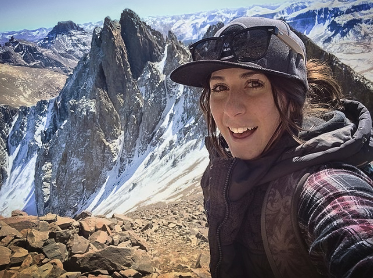
The summit of Mount Sneffels is a great place to take in the epic views of Telluride, Yankee Boy Basin and Blue Lakes Basin below.
Directions to the Trailhead
The hike to Mt. Sneffels provides two route choices, via Yankee Boy Basin or Blue Lakes. We opted for Yankee Boy basin, because of our high clearance 4×4 vehicle, we were able to drive the road and hike from where the road ended.
Yankee Boy Basin: Head south out of Ouray on County Road 361 and keep to the right at Camp Bird. If you intend on driving up the road, we recommend a 4WD high clearance vehicle.
Blue Lakes via East Dallas Road: From Ridgeway, head west 4.7 miles on Colorado Highway 62 on the Road towards Telluride to the East Dallas Creek National Forest access road and turn right (south). Follow this road to the end.
8. Lizard Head Pass Trail
Trail Length: 11.7 miles (loop) OR 7.6 miles (out-and-back)
Elevation Gain: 3,000 feet
Difficulty: Moderate/Difficult
Trail Traffic: Heavy Use
- Trailhead Directions: All Trails Map
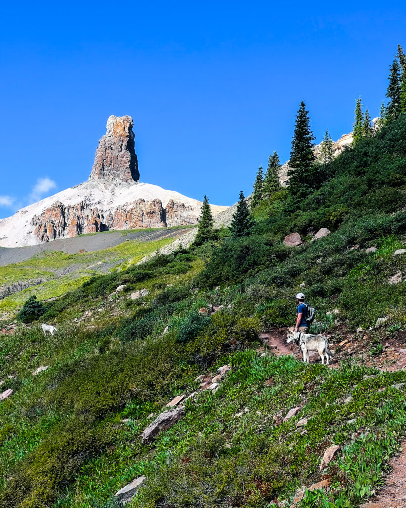
The Lizard Head Pass hike is one of the most popular trails in the Telluride area. The hike begins at the base of Blackface Mountain and traverses the panoramic spine of the mountain before reaching the base of Lizard Head Peak. The peak is an eroded 400-ft. tall spire shaped like the gaping maw of a lizard with its face to the sky. The hike is pretty intense, with a steep incline for much of the way. However, the views from the top are well worth the effort.
On the way back down, we scavenged for Chantrelle mushrooms in the spruce/fir forest. We were rewarded with a bountiful harvest of delicious mushrooms. Hiking Lizard Head Pass was an unforgettable experience and I would highly recommend it to anyone visiting Telluride.
Other Telluride Trails To Consider:
Wilson Peak
Wasatch Trail Loop
Vermillion Peak
Whipple Mountain Trail
Deep Creek Trail Loop
Ajax Peak Trail
Ballard Mountain
Navajo Lake Trail
Tips For Hiking At Tellurides High Elevation
Altitude Sickness is a real thing: If you are traveling to southwest colorado from sea level, make sure you spend at least 48 hours acclimating before setting out on any hike. (check out my list of things to do in Telluride while you adjust to the altitude).
You Sunburn easier at High Elevations: If you are going to be doing some colorado hiking for long periods of time, make sure you are wearing protective layers or putting on sunscreen throughout the day. You are much closer to the sun at high elevations so be prepared.
Afternoon Thunderstorms are common in Southwest Colorado: Known for afternoon thunderstorms that can bring lightning and rain, make sure to set out on your telluride hikes early in the day to avoid getting caught in a storm!
Leave no Trace: No one likes to see trash on the trail like banana peels and dog poop bags (gross) that have been left behind with wildflowers that have been trampled over. So always pack out your waste and stay on the trail so we can enjoy these beautiful destinations for years to come.
Essential Hiking Gear For Telluride Hikes
Summer is the perfect time to hike in Telluride. Make sure your adventure on the trail goes off without a hitch – pack these essential items in your day pack:
Hat + Sunscreen: At 8,750 feet above sea level, you’ll want to bring plenty of sun protection for you telluride hike.
Water bottle: Did you know you need to drink more water when you are at higher altitudes? Carrying along a water bottle on these hikes is a must!
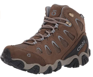
Hiking Boots: It’s worth investing in a pair of durable hiking boots to keep your feet safe and to give you plenty of traction on Colorado trails with a steep climb.
Bug Spray: avoid itchy bug bites by bringing along some bug spray.
Camera: Telluride is a beautiful Colorado destination, have your camera ready to snap some photos of your adventure.
Hiking Poles: Consider hiking poles for mountain hikes. They are extremely helpful for navigating rough terrain.
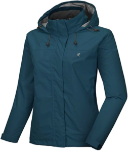
Layers: Always pack plenty of extra layers, especially a rain jacket. The weather can change quickly in the mountains, so you will want to be prepared.
Looking for More Things to do This Summer in Telluride?
Check out our list of the best things to do in Telluride this summer in our telluride travel guide. Full of free ways to explore Telluride ski resort, activities to do in mountain village, with plenty of summer festivals, learn about the area’s rich mining history. Fill your itinerary with tons of adventure and make memories that will last a lifetime in this outdoor mountain paradise.
Hiking in Telluride Colorado
So there you have it, the best hiking trails in Telluride according to a Colorado Native. I hope this post helped you figure out the exact hikes you want to do when you visit. We always have such a fun time exploring all the breathtaking views Telluride has to offer and hope you get out on some of these trails!

